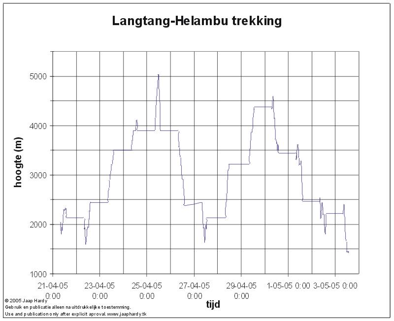
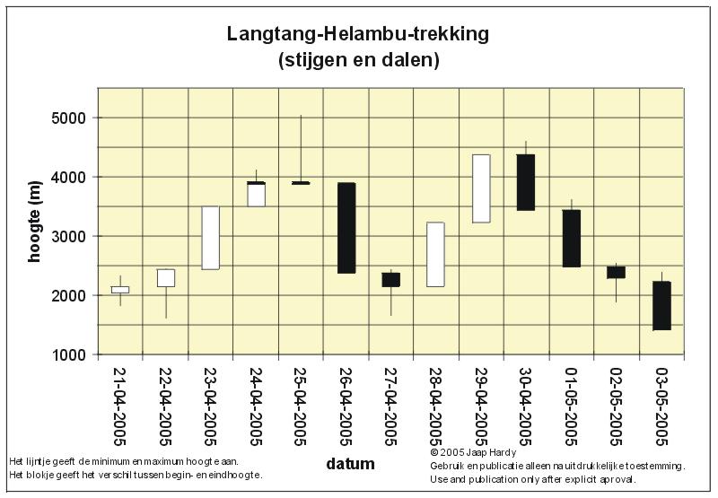
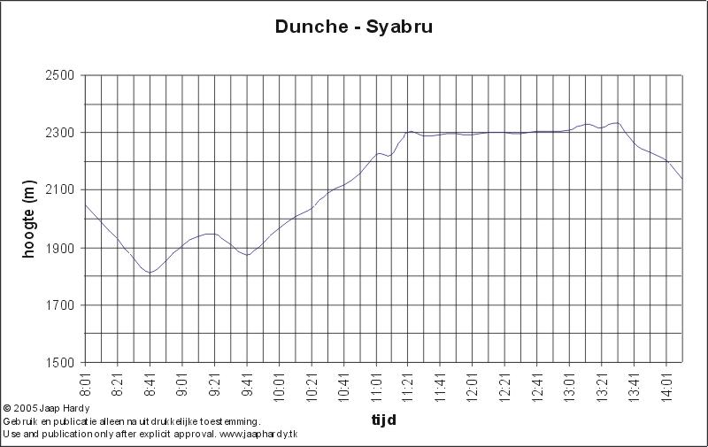
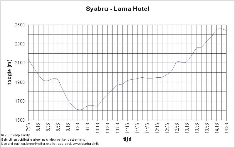
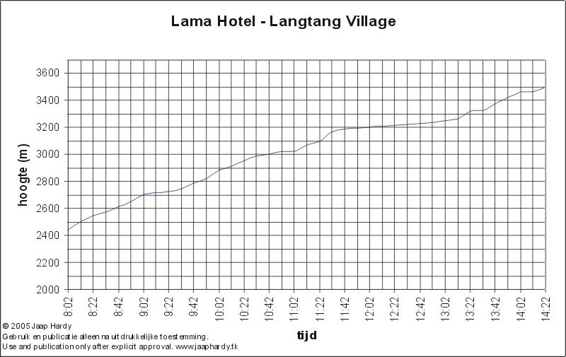
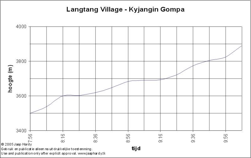
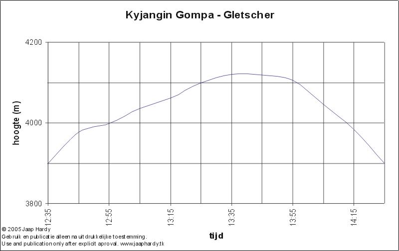
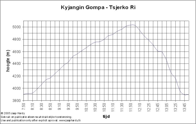
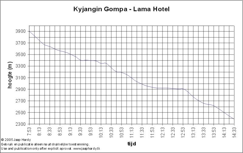
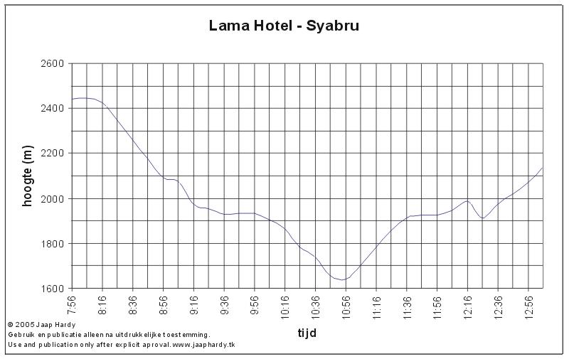
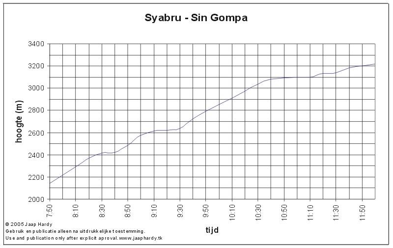
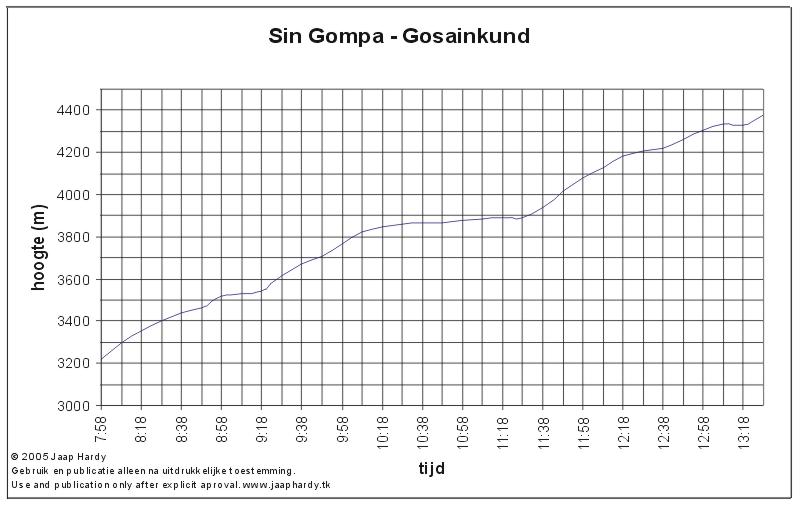
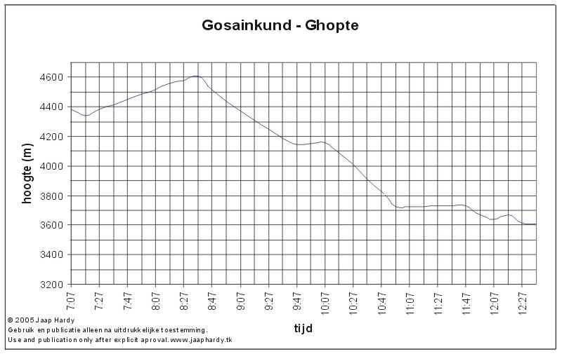
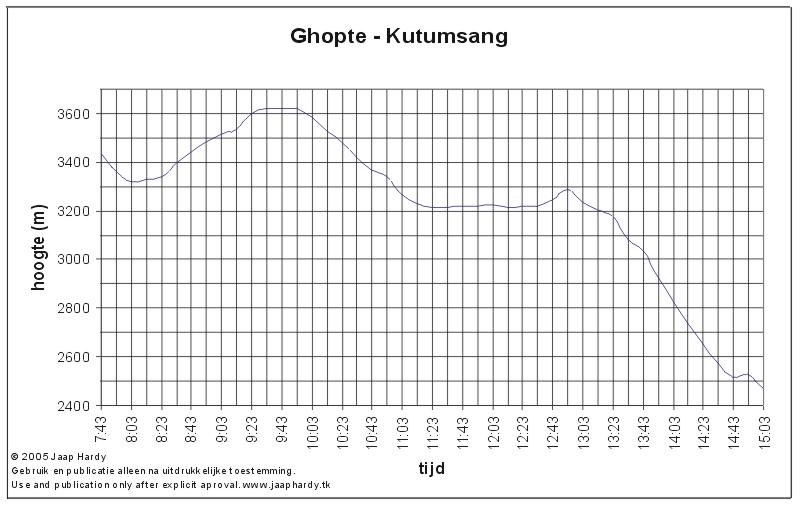
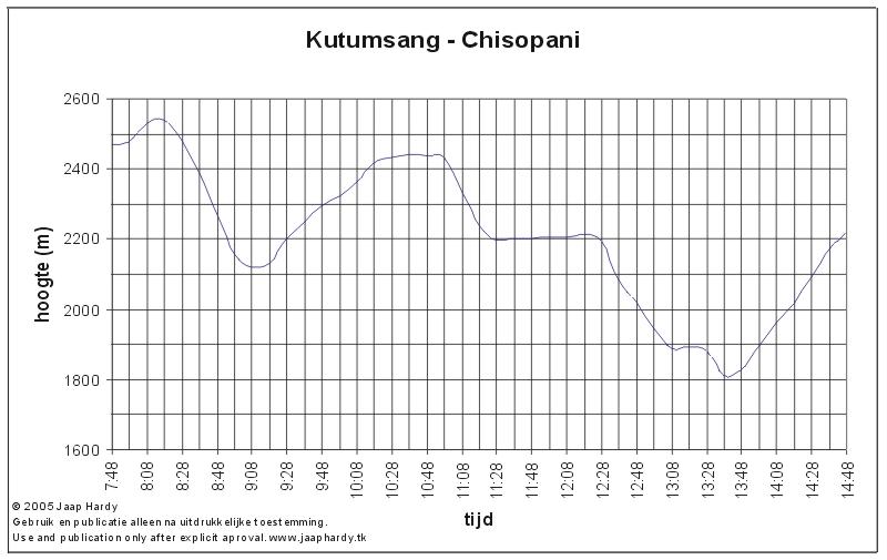
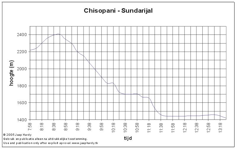
During the trekking I monitored the altitude.
I used a Suunto Vector.
It recorded the altitude every 10 minutes. Recording went on during rests and lunchbreaks.
Problem was the map-material that didn't give only one altitude for a specific place. Sometimes there were three maps, each telling a different altitude.
Every morning at the beginning of the walk I asked the guide for the altitude of the startingpoint. With this altitude I callibrated the Suunto Vecor. At the end of the day the altimeter often showed a different value then the guide told me. I have corrected the day-graph for that difference.